Officially, geomatics engineering is an information technology discipline that deals with the acquisition, modelling, analysis and management of spatial data. Geomatics engineers work in diverse teams in a discipline that is at the intersection of electrical, civil and mechanical engineering, math, physics, geography and law.
However, being a part of geomatics engineering at the University of Calgary in the Schulich School of Engineering is much more; it’s a whole experience! Here, students will form a community with people in their classes due to the small class size. A link across many disciplines (eg. software engineering, civil engineering, mechanical engineering, cartography, geography, and more) will be formed in the students’ mind which helps prepare them for the ever-changing world.
Learn more about geomatics at the UCalgary Department of Geomatics website.

Use remote sensing technology to create future autonomous vehicles 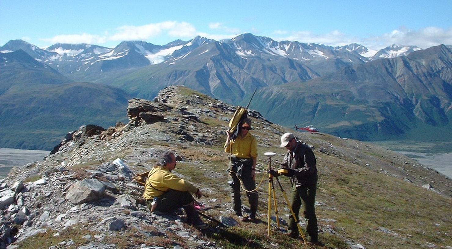
Become an ever-important land surveyor 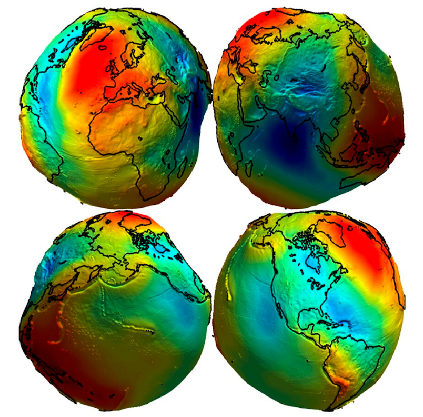
Use satellite data to update the geoid

Pokemon Go uses many geomatics-related concepts 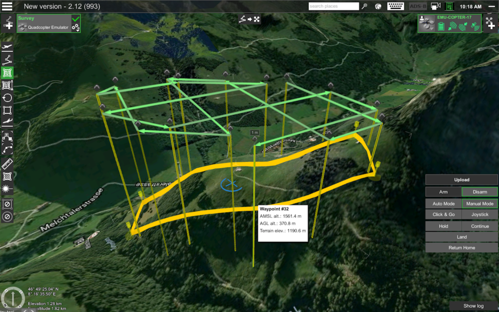
A drone flight path is created 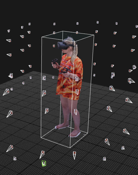
Photogrammetry is used to turn objects in reality to virtual reality